Robots · Drones
Inspired Flight IF800 remote operations: an open-autopilot Blue UAS workhorse for LiDAR and survey crews
The IF800 is a US-built heavy-lift quadcopter on an open ArduPilot stack. That openness is useful and puts more on the operator. Here is how to run it with a field pilot and a remote team, and what to check before every flight.
- Max flight time
- 54 min
- Max payload
- 3.0 kg (6.6 lb)
- Max takeoff weight
- 11.5 kg (25.3 lb)
- Max airspeed
- 22 m/s (49 mph)
- Wind
- 10 m/s, 12 m/s gusts
- Operating temperature
- -20°C to 45°C (-4°F to 113°F)
- Autopilot
- CubePilot Cube Orange+ running ArduPilot Copter, dual Here4 GNSS
- Payload interface
- Pixhawk Payload Bus, 12 V at 2 A
Updated
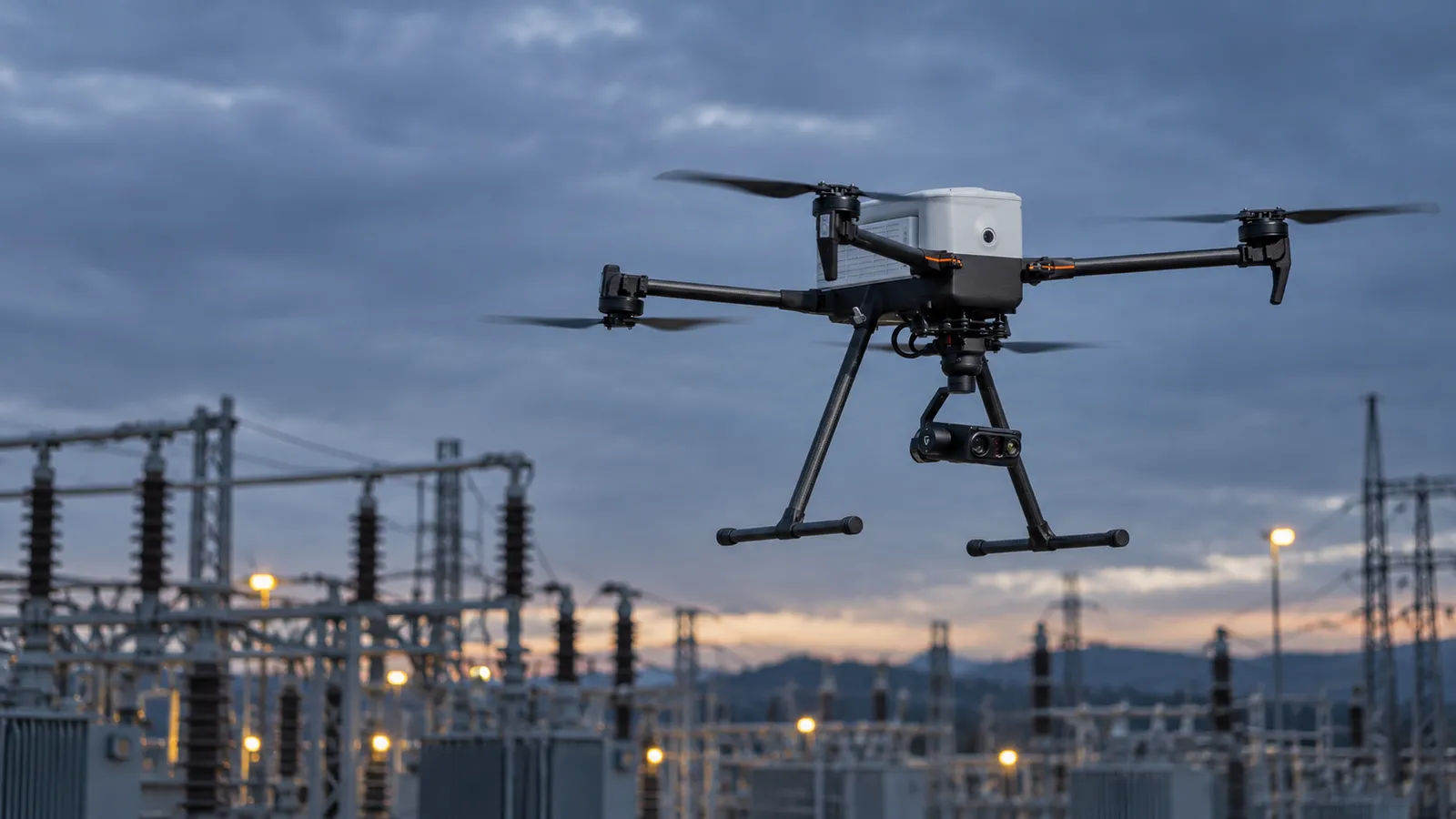
The Inspired Flight IF800 Tomcat is a US-built quadcopter that carries up to 3 kg of sensor for up to 54 minutes, on a CubePilot Cube Orange+ running ArduPilot Copter. It is on the Blue UAS Cleared List, and programs that need a heavier, longer-flying Blue aircraft for LiDAR, mapping cameras or EO/IR inspection look at it alongside the IF1200 and Freefly's Astro. The open autopilot is the IF800's main difference from closed enterprise drones. You get standard MAVLink, standard ground stations and documented failsafes. You also take on configuration choices that a closed system would make for you, and those choices decide how safe a long or remote flight is.
How an IF800 is flown
Herelink at the field
Inspired Suite
ArduPilot and MAVLink
Inspired Flight's IF800 page does not describe LTE or a cloud flight-control path, and there is no dock. In practice the IF800 is a field aircraft: a pilot on site flies it, and a remote team supports the flight. A team that wants to supervise an IF800 over a network would need its own MAVLink-over-IP setup, validated with Inspired Flight and covered by its approvals.
The failsafes an operator owns
On a closed drone, the maker decides what happens when the link drops. On ArduPilot, much of that is a parameter. ArduPilot lists radio, battery, GCS, EKF, dead-reckoning, vibration and terrain-data-loss failsafes, plus crash check, parachute and an independent watchdog. Two details matter most for remote and long-range work:
GCS failsafe
No automatic resume
Before any long or remote-supported flight, write down the failsafe settings the aircraft is actually carrying: GCS failsafe action and timeout, battery thresholds, RTL altitude above the tallest obstacle on the return path. Check them against the mission plan. A failsafe set for open farmland is wrong for a substation.
Splitting the work: field pilot and remote team
Remote: mission planning
Remote: airspace and approvals
On site: flight
Remote: fleet and log review
Remote: data delivery
With several crews working at once, the remote side is where one-to-many actually happens: one planner and reviewer supporting several field pilots. The aircraft side stays one pilot per aircraft unless an FAA waiver allows more, since 14 CFR 107.35 bars one person from acting as remote pilot for more than one aircraft at a time.
Planning a LiDAR or corridor mission
Heavy-lift survey flights fail quietly: the aircraft flies fine and the dataset is unusable. A planning standard prevents that. For each job, the mission package should fix the target point density or ground sample distance and derive altitude, speed and line spacing from it; set overlap and cross-lines for LiDAR calibration; place launch and landing points with clear approaches; mark where the aircraft will be farthest from the pilot and what the link margin is there; and state the battery plan, including the reserve at which the pilot ends a line early. The remote planner builds it, the field pilot reviews it on site against what they can see, and both sign off before the first takeoff.
Airspace and observers belong in the same package. Long corridor jobs tempt crews to let the aircraft drift beyond what the pilot can see. Under Part 107 that needs a waiver, and any waiver comes with its own conditions on visual observers, altitude and traffic detection. Where observers are used, the plan names their positions along the corridor, how they talk to the pilot, and the phrases they use to call traffic or a hazard.
Latency and range
Herelink's listed 110 ms video delay is low for a long-range link and fine for flying survey lines and framing inspection shots from the field. That number is for the radio link only. Anything relayed to a remote viewer over the internet adds its own delay and can only support observation and comment, not control. Our latency guide covers where those limits fall.
Data from an IF800
Payload classes
Positioning
Logs
Agree the deliverables before the first flight: point cloud format and density, orthomosaic resolution, thermal export, and how each file is tagged by site, asset and mission. On an open platform the payload often comes from a third party, so the delivery standard has to come from the program, not from the aircraft maker.
IF800 or IF1200?
The IF1200 is the heavier sibling: up to 8.6 kg of payload, a 24.9 kg maximum takeoff weight, up to 43 minutes of flight and a higher wind rating of 12 m/s sustained and 15 m/s gusts. It flies on the same Cube Orange+ autopilot, with dual Here3 GNSS. The IF800 carries less, 3.0 kg, but flies longer, up to 54 minutes, and is easier to transport and launch. For a single survey LiDAR or a mapping camera, the IF800 is usually enough. For heavy LiDAR, dual payloads or windier sites, the IF1200 is the one to look at. For a lighter Blue UAS mapping aircraft, compare the Freefly Astro.
What a good IF800 pilot watches for
Regulatory notes, as of October 2026
UAV Coach lists the IF800 and IF1200A on the Blue UAS Cleared List in its August 2026 check, and Inspired Flight shows Blue UAS, Green UAS and NDAA marks on the IF800 page and says its aircraft are engineered, assembled and supported in the US. For BVLOS corridor work, the FAA's Part 108 rule has been at OIRA since July 10, 2026 with no firm publication date, per PickDrones, so programs still fly under individual waivers. None of this is legal advice.
Switching a crew from a closed drone to the IF800
Pilots coming from DJI or other closed systems usually know how to fly; what they need is the platform. On the IF800 that means learning the Herelink and GS-ONE workflow, ArduPilot flight modes and what each failsafe will do, how the payload is powered and controlled over the Pixhawk Payload Bus, and how PilotGo and Elevate record the work. Budget training flights with the real payloads before production, and run lost-link and low-battery drills until the responses are automatic. Our remote drone pilot careers page describes the skills we look for.
How RoboPilots works with IF800 programs
Your field crews fly the aircraft on site. We train a dedicated remote group of Part 107 certified pilots and planners on your IF800s, your payloads, your failsafe standards and your site types, and the same group stays on your program.
One-week trial
Coverage
Data
Interfaces, specs and sources
- Herelink ground station
- Inspired Suite GS-ONE / IGC
- Inspired Suite Elevate (fleet)
- PilotGo (preflight and logging)
- ArduPilot Copter / MAVLink
- Pixhawk Payload Bus
Availability: Sold by Inspired Flight, which says its aircraft are engineered, assembled and supported in the United States and shows Blue UAS, Green UAS and NDAA marks on the IF800 page. UAV Coach lists the IF800 and IF1200A on the Blue UAS Cleared List as of August 2026. No prices are listed on the product page.
Specs are the maker's published figures, checked on . RoboPilots is not affiliated with Inspired Flight; product names are trademarks of their owners.
- Inspired Flight IF800 Tomcat product page
- Inspired Flight IF1200 product page
- Inspired Suite (Elevate, GS-ONE / IGC, PilotGo)
- CubePilot Herelink overview
- ArduPilot Copter documentation
- ArduPilot Copter failsafes
- ArduPilot Copter GCS failsafe
- UAV Coach: Blue UAS Cleared List (checked August 2026)
- 14 CFR 107.35, operation of multiple small UAS (LII)
- PickDrones: Part 108 BVLOS final rule at OIRA (September 2026)
Frequently asked questions
- What is the IF800 Tomcat's flight time?
- Inspired Flight lists a maximum flight time of 54 minutes. Actual time depends on payload and conditions, and the maker offers a flight-time calculator for estimates.
- How much can the IF800 carry?
- Up to 3.0 kg (6.6 lb) of payload, with a maximum takeoff weight of 11.5 kg (25.3 lb). Payloads connect through the Pixhawk Payload Bus standard at 12 V and 2 A.
- What autopilot does the IF800 use?
- A CubePilot Cube Orange+ flight controller running ArduPilot Copter, with dual CubePilot Here4 GNSS and compass units.
- Is the Inspired Flight IF800 Blue UAS?
- Yes. UAV Coach lists the IF800 and IF1200A on the Blue UAS Cleared List as of August 2026, and Inspired Flight shows Blue UAS, Green UAS and NDAA marks on the IF800 page.
- Is the IF800 an alternative to the DJI Matrice 350 RTK?
- For many survey and LiDAR jobs it fills a similar role as a Blue UAS, US-assembled aircraft carrying up to 3 kg for up to 54 minutes. Payload choices, software and workflows differ, so pilots need retraining when a fleet switches.