Robots · Drones
Flyability Elios 3 remote operations: confined-space crews, LiDAR maps and inspection data off site
The Elios 3 keeps people out of tanks, tunnels and stopes, not out of the plant. Here is how the work splits between the pilot at the manhole and the team reviewing data somewhere else, and what a clean inspection dataset looks like.
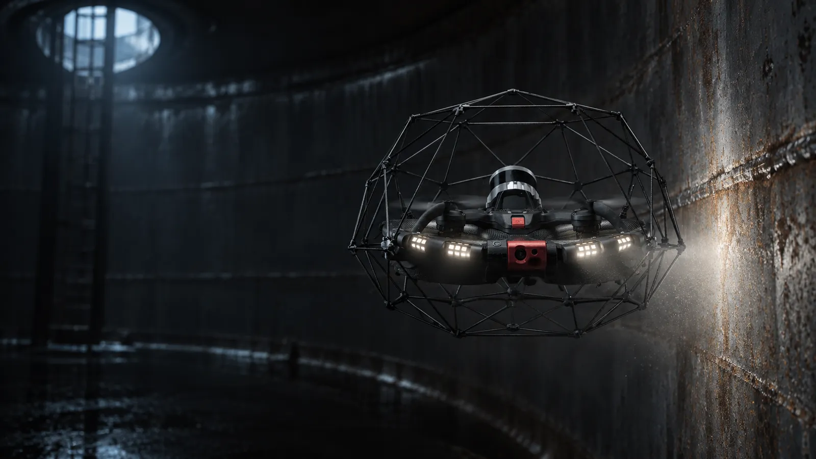
- Max flight time
- 17 min (high-capacity battery); unlimited with the Tether Power Unit
- Navigation
- LiDAR, SLAM and visual-inertial odometry; built for GPS-denied spaces
- Cameras
- 4K camera and radiometric thermal camera, oblique and dustproof lighting
- LiDAR range (standard)
- Up to 50 m at 80% reflectivity, 15 m at 10%
- Surveying payload
- Ouster OS0-128: ±1.2 cm precision (2σ), up to 100 m range, ~1.3M points/s
- Inspection payloads
- UT (2–7.5 MHz probes), RAD, gas, surveying
- Tether
- 50 m Kevlar-reinforced cable, 100–240 V AC
- Protection
- Collision-tolerant cage with flip recovery
Updated
The Flyability Elios 3 is a caged drone built to fly inside things: tanks, sewers, chimneys, culverts, tunnels and underground mine stopes. It maps its surroundings with LiDAR as it flies, holds position by SLAM where there is no GPS, and survives contact with walls because the cage, the flight controller and propeller reversal are designed together. Its value is that inspectors do not have to enter the confined space. Remote operations on an Elios 3 do not look like a dock and a browser. The pilot is at the asset, often outside the opening. Most of the inspection work can still happen somewhere else.
How an Elios 3 is flown
Remote controller and Cockpit
Range Extender
Assisted autonomy
Tether Power Unit
Flyability is direct about the limits of autonomy. Its autonomy page says the Elios 3 is not yet fully autonomous, "supervision is still required", and no drone can guarantee zero crashes. Plan the job around a trained pilot, not around the software.
Splitting the job: who is at the asset, who is not
Confined-space inspection usually puts three skills on one job: flying, inspecting and processing data. Only the first must be on site. A sensible split:
At the asset
Before the job, off site
After each flight, off site
After the job, off site
One pilot flies one Elios at a time; this is close, manual-assisted flight inside a structure, and there is no one-to-many mode to plan for. Where the remote team adds capacity is in making each hour of shutdown time yield a complete dataset, so the asset does not have to be opened twice.
Planning a confined-space flight
An Elios 3 job is planned around the shutdown window, not the aircraft. The plan that reaches the pilot should name the entry point and where the pilot and Range Extender antenna will sit, the order of areas to cover, the points of interest the client must have, the payload for each pass, and the battery or tether plan that fits the window. It should also carry the site's own rules: the confined-space permit, gas testing before and during the job, the attendant's role, and the call to abort. For repeat campaigns, a recorded mission from the last visit, flown again with Autonomous Repeat Flight where the subscription includes it, makes year-on-year comparison much easier, because the drone revisits the same points from nearly the same positions.
Battery or tether?
On battery, the Elios 3 is quick to deploy and free to move through openings and around corners, with up to 17 minutes per pack on the high-capacity battery. On the Tether Power Unit, it trades that freedom for a 50 m cable and no time limit, which suits long, slow work such as a full UT grid on one wall or a detailed survey of a large chamber. The tether also gives a physical line back to the opening, and the drone can still land on its backup battery if site power drops. Flyability notes the ground unit has no battery, which simplifies shipping it as drone equipment. Many campaigns use both: battery flights to survey and find areas of concern, tethered flights to measure them.
Latency and the link inside steel
Radio inside a steel tank or underground stope is the limiting factor. The Range Extender exists because the signal does not reach around corners or through walls. A remote reviewer is not in the control loop at all: the pilot flies with the local link, and off-site staff work from data after each flight, or from whatever view the site can share. Do not plan for a remote pilot flying an Elios 3 over the internet. Our latency guide explains why close-quarters control needs the operator next to the link.
Payload workflows
UT thickness
Surveying
RAD and gas
Data delivery: what comes out of Inspector 5
Per Flyability's export guide, a per-flight export can include points of interest as .jpg, video as .MOV, thermal video as .mp4, maps as .las, the trajectory as .csv and UT data as .csv. Inspector 5 also extracts frames and a .p4d project for PIX4Dmapper, and .geoslam files for FARO Connect. Two practical rules from the same guide: per-flight exports cannot be re-imported into Inspector, so archive with the workspace export, and keep the folder structure and file names intact when sharing.
What a good Elios 3 pilot does
Rules and approvals
Flyability's Europe regulations note says indoor operations are not affected by the EU drone regulation, that taking off outside before entering a sewer or tank may fall under the Specific category, and that a flight enclosed from takeoff can potentially be considered indoor. Outdoors, it says the Elios can fly in the Open A3 or Specific category, and Remote ID is required in Specific operations. Flyability also says the Tether Power Unit is compliant with the C5 class marking under EU rules. For US jobs, confirm with your aviation counsel how a given flight is classified; this page is not legal advice. The Elios 3 is not on the Blue UAS Cleared List as of August 2026, per UAV Coach, which matters for some federal buyers.
How RoboPilots supports Elios 3 programs
Your pilots fly at the asset. We train a dedicated remote team on your Elios 3 setup, your payloads, your asset types and your reporting standards, and the same team stays on your program.
One-week trial
Coverage
Data
For the inspection role itself, see inspection robot operator careers. For the industries where these spaces are, see agriculture and infrastructure robots.
Interfaces, specs and sources
- Elios 3 remote controller + Cockpit app
- Inspector 5 / Inspector Online
- FARO Connect (SLAM processing)
- Range Extender
- Tether Power Unit
- Training simulator
Availability: Sold by Flyability and its partners. Not on the Blue UAS Cleared List as of UAV Coach's August 2026 check. Flyability does not list prices on the Elios 3 page.
Specs are the maker's published figures, checked on . RoboPilots is not affiliated with Flyability; product names are trademarks of their owners.
- Flyability Elios 3 product page
- Flyability drone autonomy software
- Flyability Elios 3 surveying payload
- Flyability Elios 3 UT payload
- Flyability Tether Power Unit
- Flyability knowledge base: Range Extender
- Flyability knowledge base: Elios 3 training simulator
- Flyability knowledge base: Inspector 5, sharing flight data
- Flyability knowledge base: Europe flying regulations
- UAV Coach: Blue UAS Cleared List (checked August 2026)
Frequently asked questions
- How long does the Elios 3 fly?
- Flyability lists a 17-minute maximum flight time with the high-capacity battery. With the Tether Power Unit and its 50 m cable, flight time is no longer limited by the battery.
- What payloads are available for the Elios 3?
- Flyability offers UT thickness measurement, RAD radiation measurement, gas detection and a surveying payload with an Ouster OS0-128 LiDAR for survey-grade 3D scans.
- Can the Elios 3 fly without GPS?
- Yes. It is built for GPS-denied spaces and navigates with LiDAR, SLAM and visual-inertial odometry, building a 3D map in real time as it flies.
- Can the Elios 3 be flown remotely from another location?
- Not in the usual remote-operations sense. The pilot flies on site with a local radio link, often from outside the confined space using the Range Extender. Planning, data review and processing can be done off site.
- What file formats does the Elios 3 produce?
- Inspector 5 exports points of interest as JPG, video as MOV, thermal video as MP4, maps as LAS, trajectories as CSV and UT data as CSV, plus project files for PIX4Dmapper and FARO Connect.